The GNSS receiver uses up to 50 satellites to accurately determine and update the location of the vessel. The device supports 4 navigation systems: GPS, GLONASS, Galileo, Beridou.
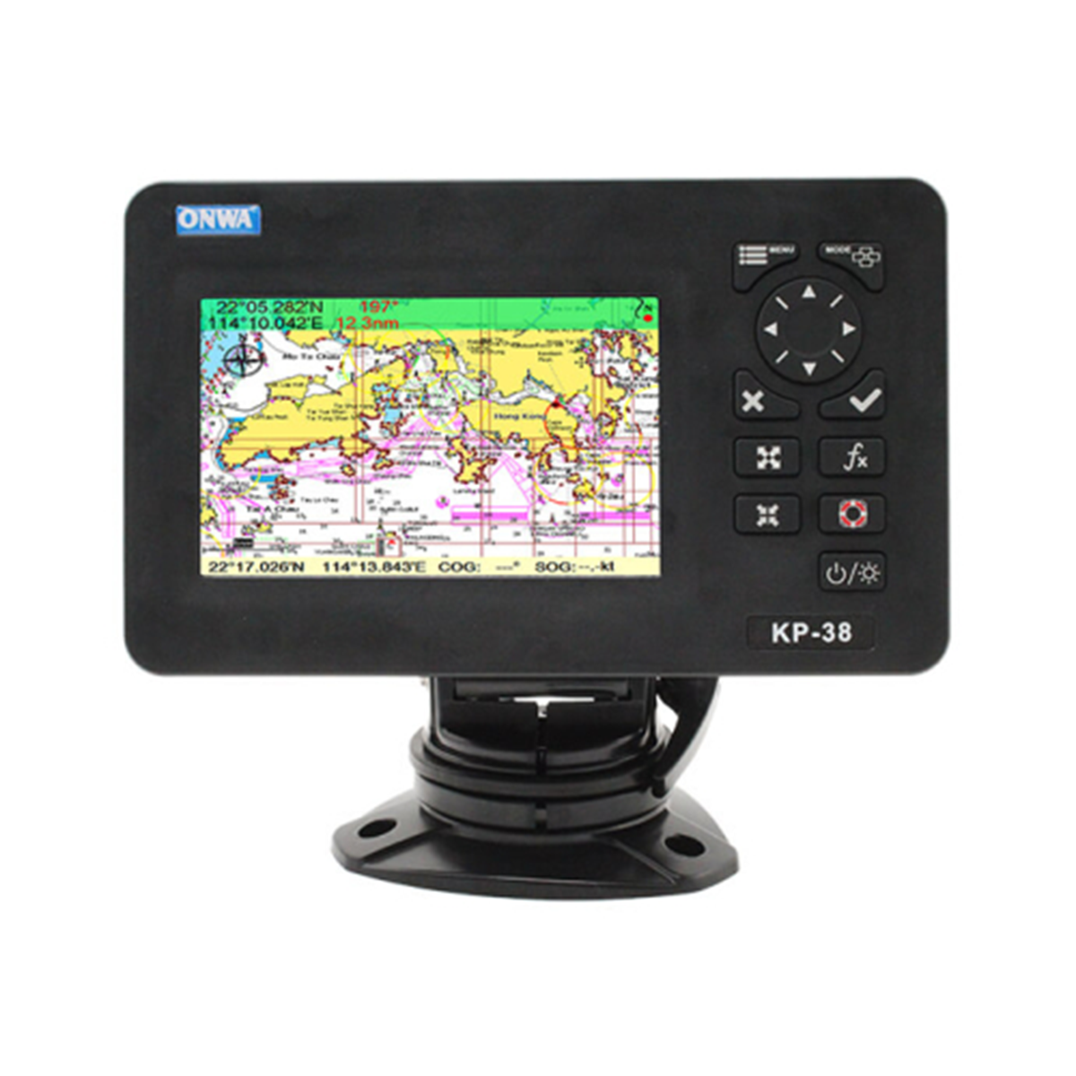
The KP-38S chartplotter consists of a GPS receiver, display, computing unit with software, control keys, and storage of cartographic information. Thanks to the extended card file, the device will help to avoid danger on the water. The IP66 protection class allows the chartplotter to be used in difficult operating conditions.
Application areas:
- Marine Safety:
The chartplotter has a MOB (Man Overboard) function, which helps ensure safety in an emergency. - River navigation.
The KP-38S chartplotter supports operation with 4 navigation systems, providing the ability to update data on the location of the vessel, control the set course by the navigator. - Sports, water activities.
GPS chartplotter is used on small watercraft (boats, yachts, etc.), due to the lightness of the equipment, its compactness.
Reasons to buy:
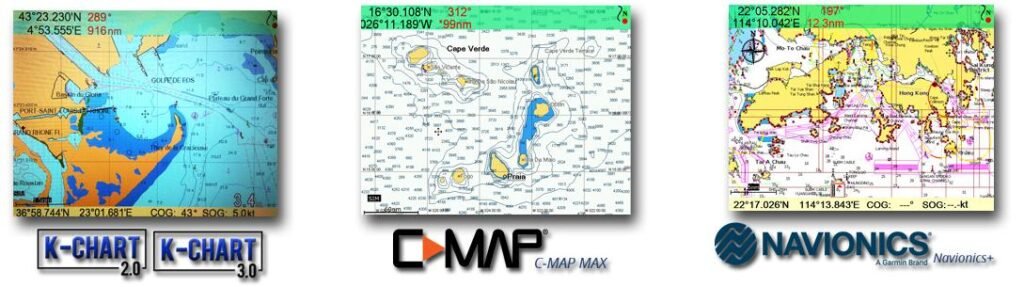
- Compatible with C-Map MAX, Navionics +
- Power bank power supply
- Support GPS, GLONASS, Galileo, Beridou
- Protection class IP66
- Compactness, lightness of equipment
Compatible cards
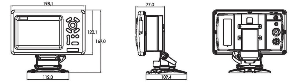
Dimensions