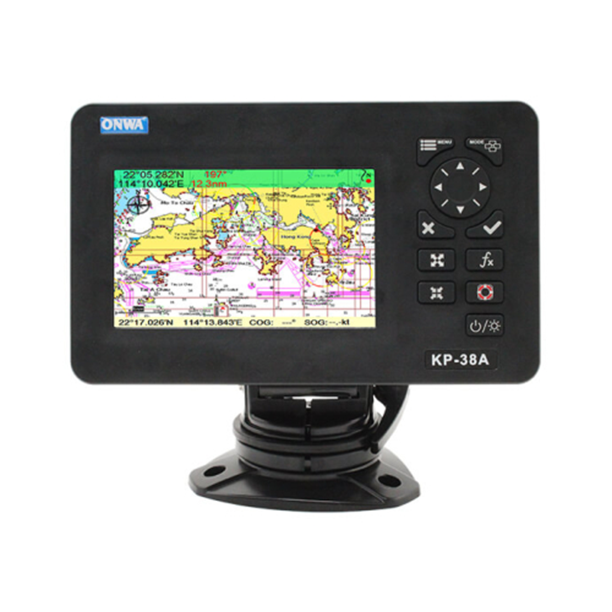
Chartplotter Onwa KR-38A
The memory of this Onwa chartplotter can store 12,000 user waypoints, a maximum of 30 routes. It has an automatic track log for 8,000 points, allowing you to track the vessel’s route in both directions. The chartplotter display complies with the IPX5 protection class: it will withstand exposure to low-pressure water jets. The antenna has an IP66 protection rating: it is completely protected from dust and water penetration into the shell. A GPS receiver with 50 parallel channels continuously tracks the vessel’s location using data from up to 50 satellites. The Onwa KR-38A chartplotter complies with IMO requirements, the international standard IEC 60945.
Application areas
- Navigation. Ensures safe navigation by tracking and displaying the vessel’s location, course information, and maneuvers.
- Shipping. Chartplotter allows watercraft to exchange various data with other watercraft, shore services for the safety of navigation.
- Security, protection. Can be used to monitor suspicious activity, control transportation, patrol waters.
Reasons to buy
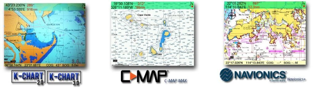
- Supports K-Chart 2.0, K-Chart 3.0, C-Map Max, Navionics + charts.
- Automatic route log for 8,000 points, ability to track the vessel’s route in both directions.
- GPS receiver with the ability to use data from 50 satellites.
- Compliance with IMO requirements, international standard IEC 60945.
Compatible cards
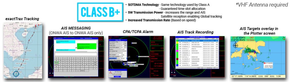
AIS capabilities
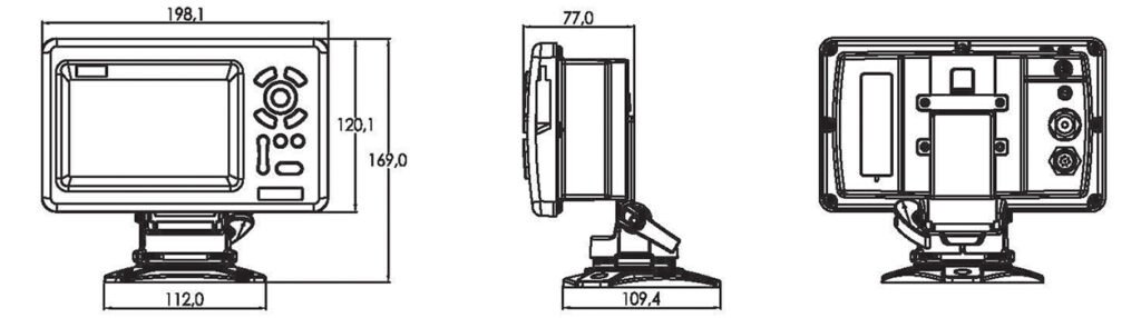
Dimensions