Chartplotter GPS KP-38/ONWA
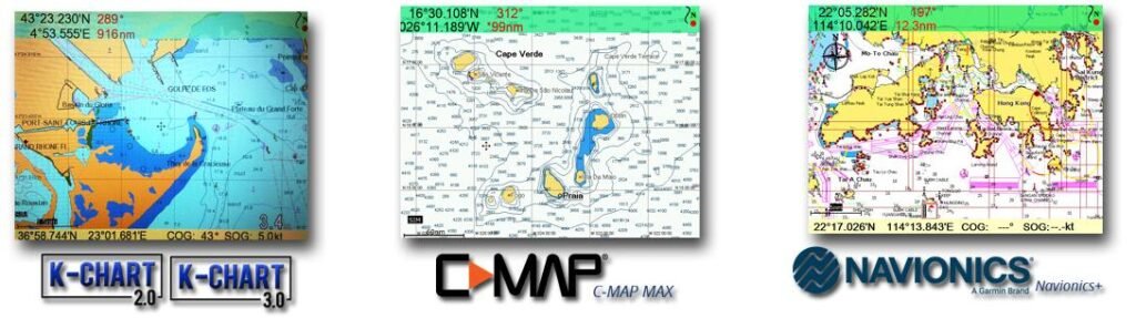
The KP-38 chartplotter is a compact 5-inch GPS plotter for ensuring navigational safety of navigation. The KP-38 chartplotter displays the location of the vessel on electronic maps, allows exchanging navigation and other data with other vessels and coastal services. The navigation device from ONWA Marine supports K-Chart 2.0, K-Chart 3.0, C-Map Max, Navionics + maps. Compatible with GNSS GLONASS, GPS, Beidou, Galileo.
$145.00
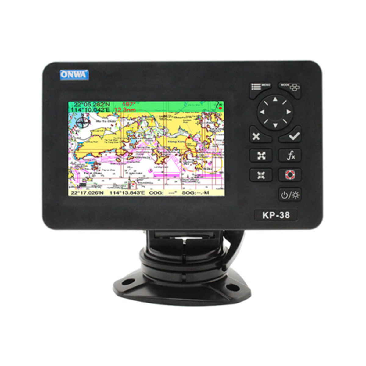
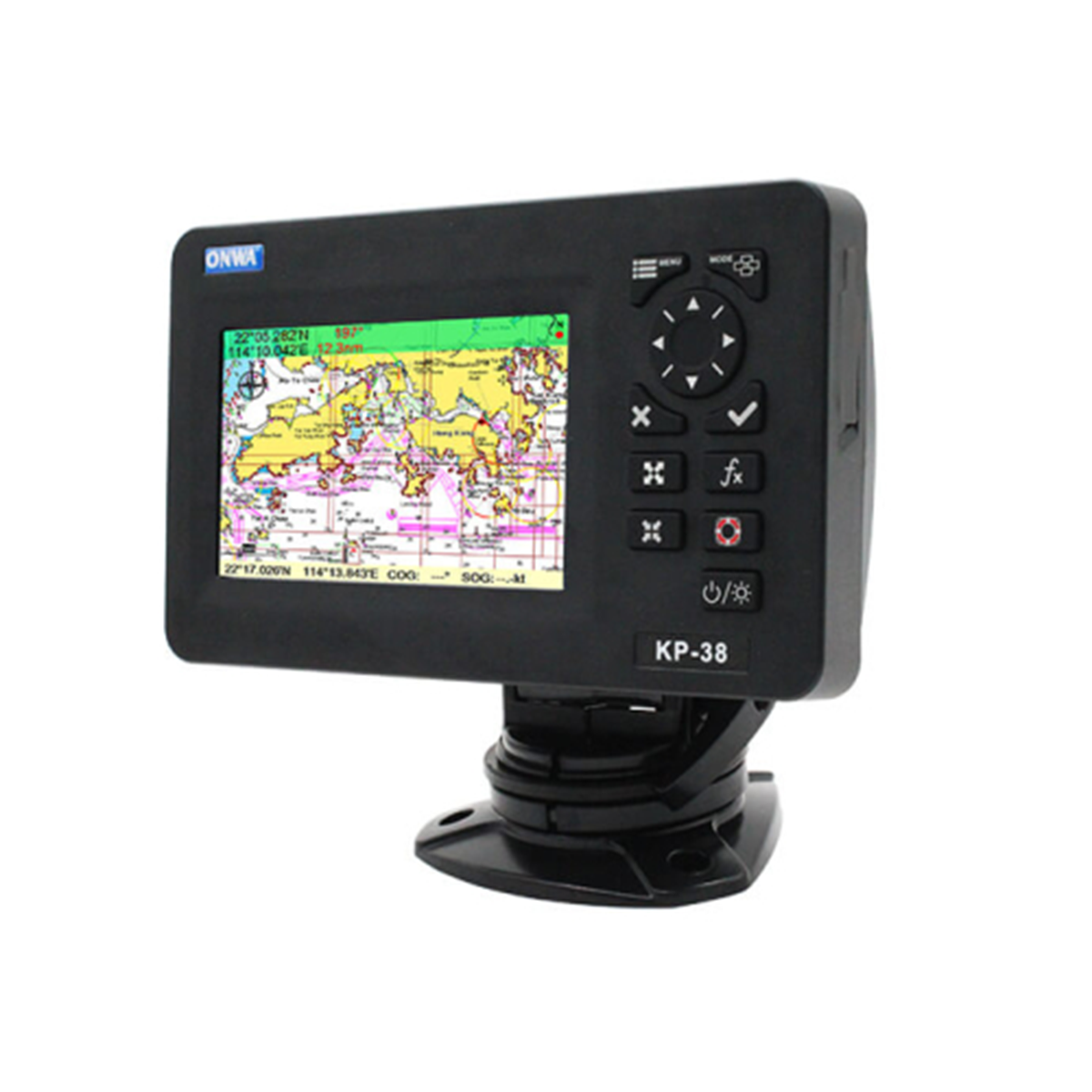
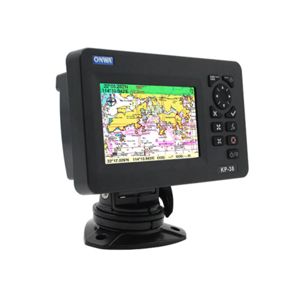
Chartplotter Onwa KP-38
The chartplotter memory can store 12,000 user waypoints, a maximum of 30 routes. It has an automatic route log for 8,000 points, allowing you to track the vessel’s route in both directions. The display and antenna of the chartplotter have an IP66 protection rating: completely protected from dust and water penetration into the shell.
A GPS receiver with 50 parallel channels continuously tracks the vessel’s location using data from up to 50 satellites.
Application areas
- Navigation. Ensures safe navigation by tracking and displaying the vessel’s location, course data, and maneuvers.
- Security, protection. Can be used to monitor suspicious activity, control transportation, patrol waters.
Reasons to buy
- Supports K-Chart 2.0, K-Chart 3.0, C-Map Max, Navionics + charts.
- Automatic route log for 8,000 points, ability to track the vessel’s route in both directions.
- GPS receiver with the ability to use data from 50 satellites.
- Compliance with IMO requirements, international standard IEC 60945.
- Degree of protection IP66.
Compatible cards
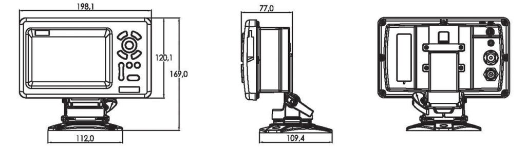
Dimensions
Plotter characteristics | |
Waypoints/Marks | 12,000 user waypoints with name, symbol, 3 system waypoints: MOB, Start, Cursor, 10 approach points |
Routes | 30 routes with waypoints, up to 170 points each, as well as MOB, track or go to track navigation modes |
Tracks | Automatic tracking log 8000 points 10 saved routes (up to 8000 points on each) Allows you to track your route in both directions. |
Alarm signals | XTE, Anchor Drift, Arrival, Speed, Voltage, Waypoint Proximity, Timer, AIS Alarm (CPA/TCPA) |
Drawings | 1000 characters to draw; 2000 lines to draw (40 dots each); 1000 place names; 8 colors to draw |
Palette | Normal, Sunlight, Night Mode, NOAA Map Color |
Ebb and flow | Built-in tide data for around the world |
Position format | LAT/LON |
Base map | Worldwide |
External map | Compatible with K-Chart2.0, K-Chart3.0, C-MAP MAX, Navionics+ |
Storage of user data | Internal backup of user settings or external SD card |
Plotting intervals | from 5 seconds to 60 minutes or from 0.01 to 1 m |
Construction of scales | from 0.001 to 700 nm |
Perspective view | On/Off (C-Mar only) |
Celestial bodies | Sunrise/Sunset/Moonrise/Moonset |
GPS receiver characteristics | |
Receiver | With 50 parallel channels, continuously tracks, uses up to 50 satellites to calculate, update location |
Data collection time | Cold start: 29 seconds Hot start: 1 second |
Refresh rate | 1 sec. or 0.1 sec. (selectable) |
Accuracy | Position: 3m (95%) without S/A |
Speed | 0.1 m/s without S/A |
SBAS | Supports |
QZSS | Supports |
Satellite system | Choice of 4 GNSS: GPS, Beidou, GLONASS, Galileo |
Dynamics | Altitude: 18,000 m Speed: 515 m/s |
System | WGS 84, user defined |
Antenna | GPS |
GPS interface | |
GPS data | RS232 input/output, NMEA 0183 V3.01, NMEA 0183 V4.11 |
GPS Input Signal Frequency | Auto scan (4800, 9600, 19200, 38400) |
GPS data transfer rate | Select between 4800, 9600, 19200, 38400 |
AIS interface | |
AIS data | Output RS232, VDO, VDM, GGA, GSA, GSV, VTG |
AIS Input Baud Rate | 38400 from GPS input port |
Support for NMEA0183 protocol | |
ENTER, auto scan speed | GGA, GLL, GSA, GSV, RMC, HDG, HDM, HDT VTG, ZDA, MTW, VWR, VWT, MWD, VPW, VHW TLL, TTM, VDO, VDM, GNS, MTA RMA, DBT, DPT, MWV, BWC, XTE, ZDL, WPL, AAM, APB, BOD, RMB, DSC, MDA, RPM, XDR |
OUTPUT, data transfer rate: selectable 4800, 9600, 19200, 38400 | GGA, GLL, RMC, GSA, GSV, AAM, APA APB, BOD, BWC, BWR, DBT, DPT, HDT MTW, RMB, TLL, VTG, WPL, XTE, ZDA ZTG, ZDL, MWD, VPW, VWR, VWT |
Autopilot outputs | APA, APB, XTE, BOD |
Power supply | 10.5 to 30 VDC, current consumption 1.0 A at 12 V |
Physical data | |
Size, mm | 169(H)x198.1(W)x77(D) |
Weight, kg | 0.6 |
Display | 5-inch color TFT, 800×480 pixels |
Water resistance | Display (front panel): IP66 Antenna unit: IP66 |
Temperature range | Display: -15℃ to +55℃ Antenna unit: -25℃ to +70℃ |
Equipment
- Display unit – 1 pc.
- Quick Start Guide – 1 pc.
- GPS patch antenna with 4m cable (SMA connector) – 1 pc.
- Mounting brackets – 1 set.
- Standard set of spare parts and installation materials – 1 pc.
Related products
-
SPM-P03
$4.00 -
SPM-B01
$2.00 -
RS-38M
$128.00 -
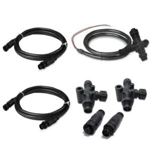
SPW-2K NMEA Starter Kit
$47.00